Maroon Bells - Aspen Trip
- Elk Range
Summary
North Maroon, Traverse, Maroon Peak Elevation North 14,019ft. Maroon 14,162ft. (Jul. 27, 2002) "North Maroon Northeast Ridge", "Traverse", and "Maroon South Ridge" trails from Maroon Lake TH. From this TH this class 1,4,4,3 trail runs (9.4 miles rt. with 4,850ft. gain). The trail starts with a nice valley walk for 2 miles until you leave the trail, cross a creek and start your uphill climb. The important part is to make the correct traverse on the front of North Maroon so that you enter the right gully and head up to North's ridge line. Once on top the traverse is reached from the south or back side of North. The traverse is pretty straight forward and the two locations for repelling can actually be down climbed fairly easily if you are not afraid of down climbing a rock crack. Finding your way up (South) Maroon Peak is a little tricky and route finding off the back of Maroon Peak and down would be impossible with poor visibility.
Read More Details or View Slideshow
Trip Schedule break down
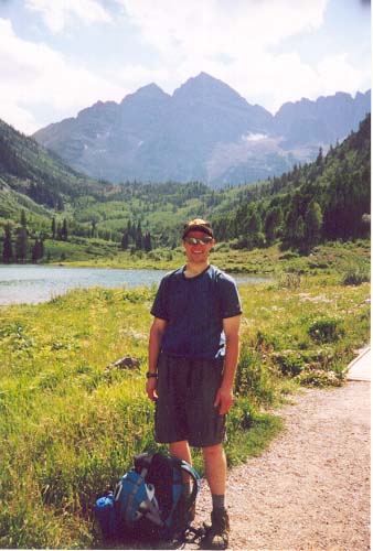
| Friday | 2:15PM | -leave work (I-70 to Glenwood Springs, I-82 to Aspen, Maroon Lake Rd. |
| 7:00PM | -arrive at Maroon Lake TH after paying a $10 park fee. | |
| Saturday | 4:00AM | -leave the TH to climb North Maroon Peak |
| 8:15AM | -summit North Maroon Peak | |
| -traverse between North Maroon Peak and Maroon Peak. The Traverse involved two repels. | ||
| 10:55AM | -summit Maroon Peak. | |
| 4:15PM | -back at the TH. | |
| 4:20PM | -beers at Maroon Lake Day parking lot picnic area. | |
| 6:45PM | -arrive at Quincy's Bar and Grill in Leadville after taking I-24 over independence pass. | |
| 10:40PM | -arrive back in Denver after Prime Rib at Quincy's. |
Next you go across a small green tundra ridge and approach the "Rock Glacier" (talk about in all the trail guide books). Cairns clearly mark the path across the glacier and to the pivotal traverse into the first gully/terrace steps up North Maroon. Toward the top of the gully you have a choice of going to the south or left that traverses over to another gully and up to North's ridge (this might be easier), or going right to North's ridge and doing a short class 4 move up one of the bell cord and continuing to follow the ridge. We decided to follow Gerry Roach's book and head to the ridge. Once on top of the bell cord you end up on top of the gully that was describe as the first choice above.
You traverse the top of this gully to the south and an area that cliffs out. With a cliff edge to the south you turn back to the right to do a class 4 move up a bell cord. The move up this cord and to the south along a narrow ledge is probably the most difficult part of the climb. Once you go around this ledge and carefully avoid the bad rock (which is hard because this mountain contains so much of it) you continue up the ridge line following cairns to the top.
Traverse from North Maroon Peak to Maroon Peak
This is where things get fun, you get your first chance to descend the nasty rock
of the Bells. Off the back side of North a trail leads steeply down to the top
of the traverse. Cairns clearly mark the trail across the traverse. Follow the
trail along the top of the traverse and sometime along the back side or
west side of the ridge. The first repel area comes about half way between the two
peaks and already has some webbing setup (and two carabineers that we left, unless
they have now been added to someone else's collection...thieves). This repel is
not too bad, I down climbed the first part but then took advantage of the rope
we brought, and repelled the second part of this first repel area. After
retrieving the rope we headed back around the ridge in line with the Maroon
Peak; the repel is off the west side of the ridge. The next repel is about
100yds from the previous repel when walking towards Maroon Peak.
The second repel just like the first repel could have been down climbed...but hey we packed the 10lb rope up North, we must at least get some use out of it. After this point you again continue down the ridge and down climb into a ravine (what a bummer on the elevation loss). On the other side you start your way up Maroon Peak The trail here is hard to follow; it starts to west and then wraps around to the east side. We missed the wrap back to the east part, but from the signs of foot prints we where not the first to have a problem with the part of the trail. We ended up climbing a up a ravine/rock bowling alley. Once back on top of the ridge the trail heads around to the east and directly in line with the top of the peak. Climb the front side of Maroon to the summit.
Maroon Peak
Getting down from Maroon Peak leads to new challenges in route finding. It always
seems easier to follow a trail up then to find it on the way down. The trail
follows the ridge line off of Maroon to the south, then descends to the west a
ways. While descending always try to keep an eye to the south and the many finger
gorges (Think of a mountain that is a cone made with an ellipse at the base. Take
your fingers and brush down one of the sides. When your finger brush down the
side of the mountain, ridges are formed between each finger. This is what the
back side of Maroon peak looks like.). The traverse to the south dips into
the mountain the then back out to ridges. Always make sure to stay high enough to
reach the next ridge to the south. Each ridge to the south seemed to have many
cairns on it indicating the part of the ridge where the traverse continues along.
After some tricky route finding and traversing you make it to a saddle that is
part of the main ridge of Maroon Peak.
The saddle is fairly well marked. The trail from here runs down a gully on the East side of the ridge down to West Maroon Creek Trail. Down climbing from this ridge is straight forward but very punishing with loose rock and dirt, and did I mention NO SWITCHBACKS. After you mash all your toes into the front of your boots or stretch out all the tendons in your knees, during the 3000ft. descent, you reach the somewhat level Trail of West Maroon Creek. Now it is just an easy hike back to the parking lot...although this did not seem so easy after having the energy drained from my legs during the previous 10hours of climbing.
COLD BEER, COLD BEER, COLD BEER.