Mount Princeton - Buena Vista Trip
- Sawatch Range
Summary
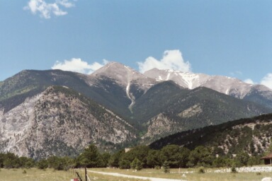
Mount Princeton Elevation 14,205ft. (June 27, 2003) "East Slopes" trail from Princeton Road Trailhead. The Princeton road trail from the radio towers up Mount Princeton is a class 2 trail that runs (6.0 miles rt. with 3,300ft. gain). In my research for this adventure I had heard conflicting stories about the Princeton Road (rough, narrow, best to leave your car at the bottom), but the road was no trouble. I did have to do a little maneuvering to let three cars by that were coming down the road. After parking just past the radio towers, I started my climb up Princeton on a perfectly clear Friday afternoon. The climb was straight forward and the afternoon was sunny and warm.
Read More Details or View Slideshow
Trip Schedule break down
| Friday | 12:00PM | -left work (Drive to Buena Vista and up Princeton Road) |
| 2:30PM | -arrive at Princeton Road Radio tower TH. | |
| 2:45PM | -leave TH to climb Mount Princeton. | |
| 4:35PM | -Summit Mount Princeton via | |
| 2:30PM | -arrive at Princeton Road Radio tower TH | |
| Saturday | 5:30AM | -see Harvard Group climb |
| Sunday | 5:30AM | -see Mount Yale climb |
| 9:00PM | -back at Home. |
I had decided to combine two trips into one this weekend and would either climb Mount Princeton on Friday afternoon or Sunday afternoon, whichever one had the better weather. Driving down 285 to Buena Vista I saw Princeton and the entire valley had clear skies. This really got my heart pumping, as I knew that I would be able to get in a climb this afternoon.
The climb up the 4X4 road was easy and I found the hikers trial right where it was suppose to be, at the cut off right before the last switchback that goes straight South. The trail turn off at the switchback corner begins with a steep hill climb. Finding this cut off is the only part of the climb that takes route finding skills. Once on the ridge, the long traverse over to the actual peak was not difficult. The trails on the mountain seemed to go everywhere as I approached the mine, where the main trail would eventually take you to. Before getting to the mine I decided to climb up to the ridgeline and continue my climb from there. I ran into a couple about this point, who had already spent 9 hours on this climb and were now on their way down. The couple had started at the bottom of the road and had also taken a 4 hour detour down the Colorado Trail instead of sticking to the road until it climbed above tree line.
I somehow missed the plaque at the top of Princeton commemorated a women who had been struck by lightening. I made a couple phone calls from the summit and enjoy about 30 minutes of rest and picture taking. I could have spent several more hours on the summit, but I decided to race the shadows and setting sun back down the ridgeline and ultimately back to my truck.
On the way back I ran into a guy that asked about the climb up Princeton. I mentioned that I was going to do Harvard and Columbia tomorrow. He mentioned that Roach lied about the ridgeline. I decided that he had not really been that experienced with Roach's routes. All Roach mentions is that some routes are possible, not that they are marked. He was incessant about the fact that his friends, who he called "Mountain Studs", could not find a route across the ridgeline. I guess that you will just have to read my comments about Saturdays Harvard and Columbia trip to hear my real retort to his comments (go there now)